


Maghull to Burscough
12- 24 miles
Burscough
to Wigan
24 - 34 miles
Former Lancaster Canal South
37-47miles
Johnson's Hillock to Cherry Tree
47 - 54 miles
Map of the Leeds & Liverpool Canal
These links are to maps hosted on googlemaps.
Route Map
Route Map of the Leeds Liverpool Canal with branches
Access Map for the Leeds & Liverpool Canal (not finished yet!)
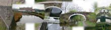
Leeds Liverpool Canal Bridges
Part One (West)
Map showing the bridges on the western end of the Leeds and Liverpool Canal
Map showing the Bridges of the Leeds and Liverpool Canal between Liverpool and Blackburn
Part Two (East)
Map Showing the bridges on the eastern end of the Leeds Liverpool Canal
Map of bridges on the Leeds & Liverpool Canal between Blackburn and Bingley
Part Three Bingley to Leeds
Map showing bridges at the Leeds end of the Leeds Liverpool Canal
World War Two Defences.
World War Two Defences around the Leeds Liverpool Canal
Google Maps
I recommend setting up an account with google, its free and allows you to keep a list of favourite maps and over lay them.
Shipley to Leeds
115 -125 miles
Stockbridge to Shipley
109 -115 miles
Skipton to Stockbridge
99 - 109 miles
Gargrave to Skipton
93 -99 miles
Greenberfield to Gargrave
87- 93 miles
Foulridge to Greenberfield
82-87 miles
